
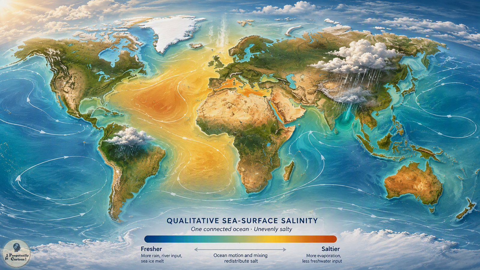
The Atlantic-Pacific salinity difference is clear on global maps: on average, the Atlantic has higher surface salinity than the Pacific. Yet these are not sealed reservoirs. They are regions of one connected global ocean, and currents continually transport water between them. If seawater mixes, and dissolved ions can diffuse through it, why do large salinity differences persist?
The broader story of why the ocean is salty explains how dissolved ions enter, remain in, and leave ocean water. But salinity is a concentration, so the amount of freshwater matters just as much as the amount of salt. Evaporation removes water while leaving nearly all dissolved salts behind, raising salinity. Rain, river discharge, and melting ice add freshwater and lower it.
That freshwater balance is uneven across the planet. Dry subtropical regions can lose substantial water through evaporation, while rainy belts and river-fed regions are fresher. The Atlantic contains broad high-salinity subtropical waters, while greater rainfall over parts of the Pacific contributes to its lower average surface salinity. Rivers can strongly freshen coastal waters, but simply counting rivers entering each ocean does not explain a basin-wide contrast.
Geography also helps move freshwater between basins. In aggregate, atmospheric circulation transports water vapor from the Atlantic toward the Pacific, including across parts of the Americas. Ocean currents simultaneously carry saltier and fresher water through the sea itself. At shorter timescales, changing Pacific rainfall patterns show how the ocean and atmosphere can reorganize freshwater distribution without creating fixed boundaries between named oceans.
None of this means mixing has failed. Currents and turbulence redistribute salinity, while molecular diffusion acts at smaller scales to smooth concentration gradients. At the same time, evaporation, rainfall, runoff, ice processes, and circulation continually create or reinforce new differences. The ocean is therefore less like a beaker left undisturbed to reach uniform composition and more like a vast, continuously forced transport system.
The same principle becomes especially clear on a global sea-surface salinity map. Monsoon rain and river discharge help keep the Bay of Bengal relatively fresh, while intense evaporation and little freshwater inflow contribute to the Red Sea’s much higher salinity. One connected ocean can therefore carry many salinities at once. Its salt map is also a map of where freshwater is being removed, returned, and moved.