

On a gray Atlantic morning, rain may tap against a window by the shore while snow gathers farther inland. One storm can make both scenes. Its center may travel toward the northeast even as wind reaches the coast from the northeast, the seeming contradiction written into the name nor’easter. To understand how one system produces so many versions of the same day, we can follow it from its winds to the meeting of land, sea, and sky.
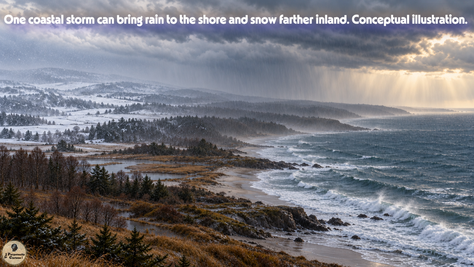
The coast holds its breath as the storm passes, leaving snowlight inland and rising water at the shore.
Each place remembers the same wind in its own way, shaped by the boundary between land and sea.
In that shifting space, the quiet story of a nor’easter continues long after the clouds have moved on.
🧭 A storm named for its wind
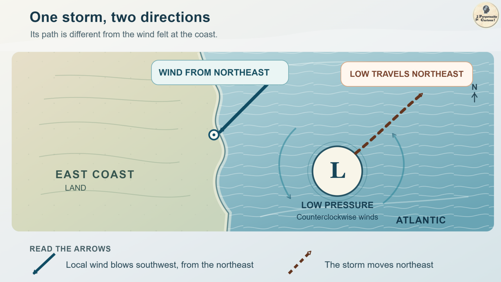
A nor’easter is a storm near North America’s Atlantic coast whose winds often blow from the northeast over affected coastal areas. Its low-pressure center generally moves northeastward. Air flows toward lower pressure, and Earth’s rotation deflects that moving air to the right in the Northern Hemisphere. Together, these motions help establish a broad counterclockwise circulation around the low. When the low lies offshore, part of its circulation can bring northeast winds onto the coast. The wind’s direction at one place and the storm’s direction of travel describe different motions.
Those winds can carry Atlantic moisture inland and push seawater toward exposed shores. Yet circulation alone does not explain why a particular low grows powerful. For that, the story moves to the contrasting air and water along its path.
🌡️ Where cold land air meets a milder ocean
During the cooler months, cold continental air can reach the East Coast while nearby Atlantic waters remain comparatively mild. The Gulf Stream helps keep offshore waters relatively warm, particularly near the southeastern coast. Where colder and warmer air meet, the temperature contrast provides a developing extratropical cyclone with a source of energy. A disturbance along that boundary may intensify if winds high above it, sometimes associated with the jet stream, carry air away from over the low. This can favor rising air and a fall in surface pressure. The ocean supplies moisture for clouds and precipitation.
As moist air rises, it cools, and cloud droplets or ice crystals can grow. Some of the cloud processes that form rain can also begin precipitation that reaches the ground as snow. Temperatures through the air below the clouds help determine what finally reaches a particular place.
Cold air, Atlantic moisture, and support from winds aloft together make this coastline favorable for nor’easters. Other ocean basins also host powerful extratropical storms. Here, the northeast wind gives the coastal storm its familiar name. If the developing low deepens rapidly, another name may enter the forecast.
📉 When a coastal low deepens quickly
Some nor’easters strengthen gradually. Others deepen fast enough to meet the definition of bombogenesis, or explosive cyclogenesis. The classic threshold is a central pressure fall of 24 millibars in 24 hours at 60° north latitude, adjusted for latitude elsewhere. Near 41° north, the equivalent is about 18 millibars in 24 hours.[1] A low that meets the threshold may be called a bomb cyclone. This describes a rate of pressure fall, not a wind-speed category or a separate kind of storm.
Rapid deepening can accompany stronger winds and heavier precipitation, but the effects depend on the storm’s size, track, and surrounding air. Pressure change tells us how the system evolves. Where a community sits relative to the low tells us what that evolution may feel like on the ground.
🌨️ One storm, several kinds of weather
On the colder side of a winter nor’easter, rising moist air can produce substantial snow, sometimes concentrated in narrow bands. Closer to the coast or the storm center, temperatures at different heights can yield sleet, freezing rain, or rain instead. As the low moves, the rain and snow line can shift.
That contrast also has a visual side. A mature extratropical cyclone often carries a broad, asymmetric, comma-shaped cloud shield. Clouds stretch along its fronts and curl around the low, giving the pattern its familiar shape. Below it, new snow can brighten an inland landscape because countless ice-and-air boundaries scatter light, an optical story explored in why snow appears white.
At the shore, persistent onshore winds can raise coastal water levels as large waves reach beaches and dunes. Under strong surf, the same wave motion that shapes sandy beaches can rapidly rework the shoreline. If a storm lingers through successive high tides, coastal flooding and erosion may recur even as conditions elsewhere begin to improve.
The split between inland snow and coastal water is one reason storm track matters so much. Duration matters too, as one historic East Coast storm made plain.
🕰️ What a long-lived storm reveals
The Ash Wednesday nor’easter of March 1962 brought severe flooding and erosion to parts of the Atlantic coast. As it slowed near the shore, its onshore winds and waves affected successive high tides. The episode shows how a coastal storm can do more than strike once: the sea may return to an already battered shoreline with the next tide.
Forecasters therefore examine not just the expected path of the low but its speed, the placement of cold air, likely precipitation bands, and the timing of onshore winds relative to the tides. A track adjustment may change a town’s rain or snow, while hours of persistent wind may shape its coastal water levels. Both the map and the clock matter.
The coastline has a longer clock as well. The level from which storm-driven water begins is itself changing in many places.
🌊 A changing baseline at the water’s edge
Where local sea level has risen, waves and storm-driven water begin from a higher baseline. That extra height can make coastal flooding more likely or extensive even if a nor’easter is no stronger than an earlier storm. Whether the number or strength of nor’easters is changing is a separate question that cannot be answered from one event.
The opening scene now comes back into focus. One low-pressure system can send wind from a direction different from its own travel, place rain beside snow, and bring water ashore across more than one tide. Its boundaries move through air and along the coast, leaving different places with different memories of the same storm.
Pass this article along to someone curious and let the learning travel.
💡 Did you know?
🕰️ In 1743, Benjamin Franklin learned that a storm had obscured a lunar eclipse in Philadelphia while observers in Boston could see it before the storm arrived there. The episode helped him infer that storms could travel northeast even when local winds blew from another direction. That event is known as the eclipse hurricane, but its lesson about motion and wind also illuminates the nor’easter’s name.[2]
⚡ Lightning can occur within the heavy snow of some nor’easters, a phenomenon called thundersnow. NOAA’s satellite instruments detected lightning during a March 2018 nor’easter, near areas experiencing intense snowfall. A scene that looks entirely wintry can still contain the rising air and electrical activity of a thunderstorm.[3]
Are all nor’easters snowstorms?
No. Depending on season and location, a nor’easter can bring rain, snow, mixed precipitation, strong winds, rough seas, or coastal flooding. These storms can occur at any time of year, although the National Weather Service describes September through April as their most frequent and intense period.
Is every nor’easter a bomb cyclone?
No. Bomb cyclone describes an extratropical low whose central pressure falls rapidly enough to meet a latitude-adjusted threshold. Nor’easters can develop without reaching that threshold, and bomb cyclones can form in other ocean basins.
How does a nor’easter differ from a hurricane?
A nor’easter is an extratropical storm associated with broad temperature contrasts. A hurricane is a tropical cyclone that draws much of its energy from warm ocean water and organizes deep thunderstorms near its core. Either can bring damaging winds and coastal flooding, but their structures and dominant energy sources differ.
What is the difference between storm surge and storm tide?
Storm surge is the storm-driven rise above the predicted astronomical tide. Storm tide is the total water level during the event, combining the surge with the tide. A high astronomical tide can therefore compound coastal flooding even if the storm-driven rise is unchanged.
Does a nor’easter have to meet the definition of a blizzard?
No. A blizzard requires sustained winds or frequent gusts of at least 35 mph (56 km/h) and falling or blowing snow that frequently reduces visibility to less than one-quarter mile (0.4 km) for at least three hours.[4] A nor’easter may meet those conditions in one area and bring rain to another.
Can El Niño tell us whether a particular nor’easter will form?
No. El Niño can alter the odds of certain seasonal jet-stream and storm-track patterns, but it does not determine the formation, path, or intensity of an individual nor’easter. The weather on a particular day depends on the atmosphere as it evolves.
✨ Let the question travel
We kindly invite you to share and spread the word. If this piece helped you see the coast and its storms differently, please pass it to friends and colleagues who may enjoy the question. Your support helps the curiosity travel farther.
Educational Context:
This article explains general weather processes and historical examples. It does not provide a forecast, warning, or assessment of current conditions for a specific location.
Selected sources
- National Oceanic and Atmospheric Administration (NOAA), National Ocean Service. (2026). What is bombogenesis? Updated September 23, 2026.
- National Oceanic and Atmospheric Administration (NOAA), Atlantic Oceanographic and Meteorological Laboratory. (2013). 270th anniversary of the ‘Eclipse’ hurricane.
- National Oceanic and Atmospheric Administration (NOAA), National Environmental Satellite, Data, and Information Service. (2018). Weird Weather – NOAA Satellites Keep Watch When Weather Gets Weird.
- National Weather Service (NWS). (n.d.). Blizzard. National Weather Service Glossary.
“How Nor’easters Form: When the Coast Becomes a Storm Engine.” The Perpetually Curious!, September 2026.
https://www.theperpetuallycurious.org/articles/how-noreasters-form/Continue Exploring
For what comes next
Site Updates gathers occasional notes, new additions, and ways to keep in touch. RSS brings new publications to your feed reader in chronological order.
Choose the path that speaks to you, and let the next curiosity find you wherever your wondering takes you.